| Chameleon skin User Manual |
Click here! |
|
Metadata
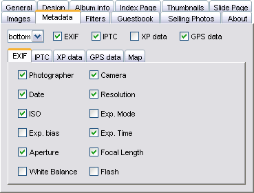
You can choose the type and position of metadata to display. Using these fields requires JAlbum to be enabled to extract these fields — you can control it with Settings / Advanced / Metadata. You can group enable/disable them by the boxes on the top. Exif Camera-generated exposition parameters (so called EXIF) data. Photographer — photographer's name if it was set in the camera in the time of taking the photo.
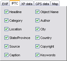
Iptc data fields, posterior commenting often used by press archives.
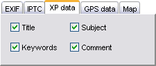
Windows XP can also attach various fields to files. You can add this information by right-clicking them in windows explorer and choosing the Properties / Summary tab.
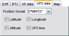
Pictures can hold GPS data (geographic coordinates) too, added either by your camera or manually. Along with the coordinates the 'reference' will be displayed too. The GPS time can be used instead of camera date, because this is exact. The coordinate format is defined by the Position format box: D=Degree / M=Minute / S=Second.
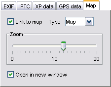
If you have GPS data added to your pictures you can have a link to Google Maps to show the place the picture was taken directly on the map. If no GPS coordinates found but the Iptc.Location or Iptc.City / Country data is available, the link will be generated with these tags. (E.g.: Paris,France) If Link to map is unchecked no link will be generated at all. The Type can be Map (regular map), Satellite picture or Hybrid — which is a combination of the first two. The Zoom level controls the enlargement of the generated map. Use 4 for a whole continent 8 for a smaller country 12 for a big city and 16 for street map. You can open the map in a new window by checking th Open in new window checkbox. |
|